基于Landsat影像和不规则梯形方法遥感反演延安城市森林表层土壤水分
Remotely Sensed Retrieving the Surface Soil Moisture of Yan’an Urban Forest based on Landsat Image and Trapezoid Method
基于Landsat影像和不规则梯形方法遥感反演延安城市森林表层土壤水分 |
| 张新平,乔治,李皓,闫杰,张芳芳,赵栋锋,王得祥,康海斌,杨航,冯扬 |
|
Remotely Sensed Retrieving the Surface Soil Moisture of Yan’an Urban Forest based on Landsat Image and Trapezoid Method |
| Xinping Zhang,Zhi Qiao,Hao Li,Jie Yan,Fangfang Zhang,Dongfeng Zhao,Dexiang Wang,Haibin Kang,Hang Yang,Yang Feng |
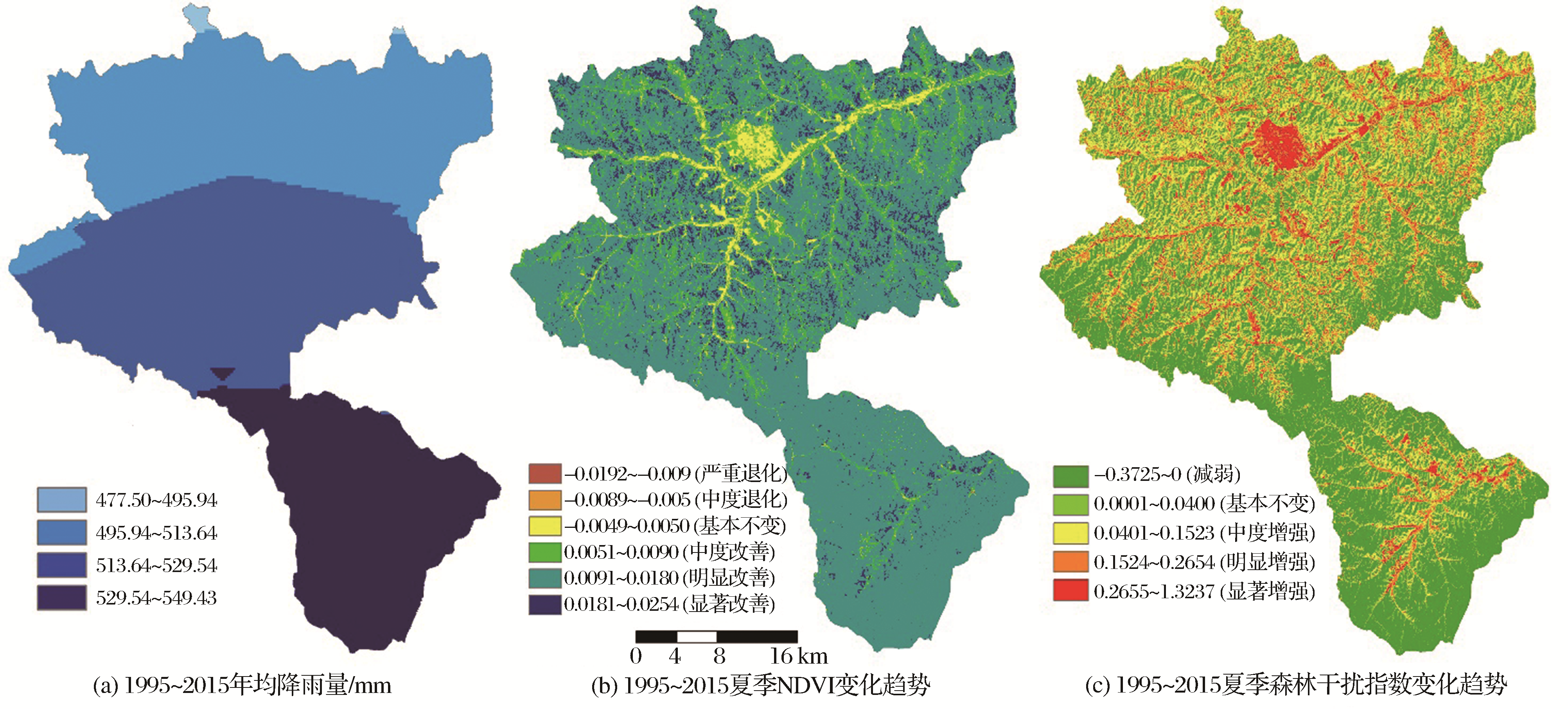
| 图9 1995~2015年年均降雨量、夏季NDVI与森林干扰指数年变化趋势分空间分布图[ |
| Fig. 9 The spatial distribution maps for mean annual precipitation, the annual variations of NDVI and forest disturbance index in summer, from 1995 to 2015 |
|
|