有云Landsat TM/OLI影像结合DEM提取青藏高原湖泊边界的自动算法研究
Automatic Algorithm for Extracting Lake Boundaries in Qinghai-Tibet Plateau based on Cloudy Landsat TM/OLI Image and DEM
有云Landsat TM/OLI影像结合DEM提取青藏高原湖泊边界的自动算法研究 |
| 王鑫蕊,晋锐,林剑,曾祥飞,赵泽斌 |
|
Automatic Algorithm for Extracting Lake Boundaries in Qinghai-Tibet Plateau based on Cloudy Landsat TM/OLI Image and DEM |
| Xinrui Wang,Rui Jin,Jian Lin,Xiangfei Zeng,Zebin Zhao |
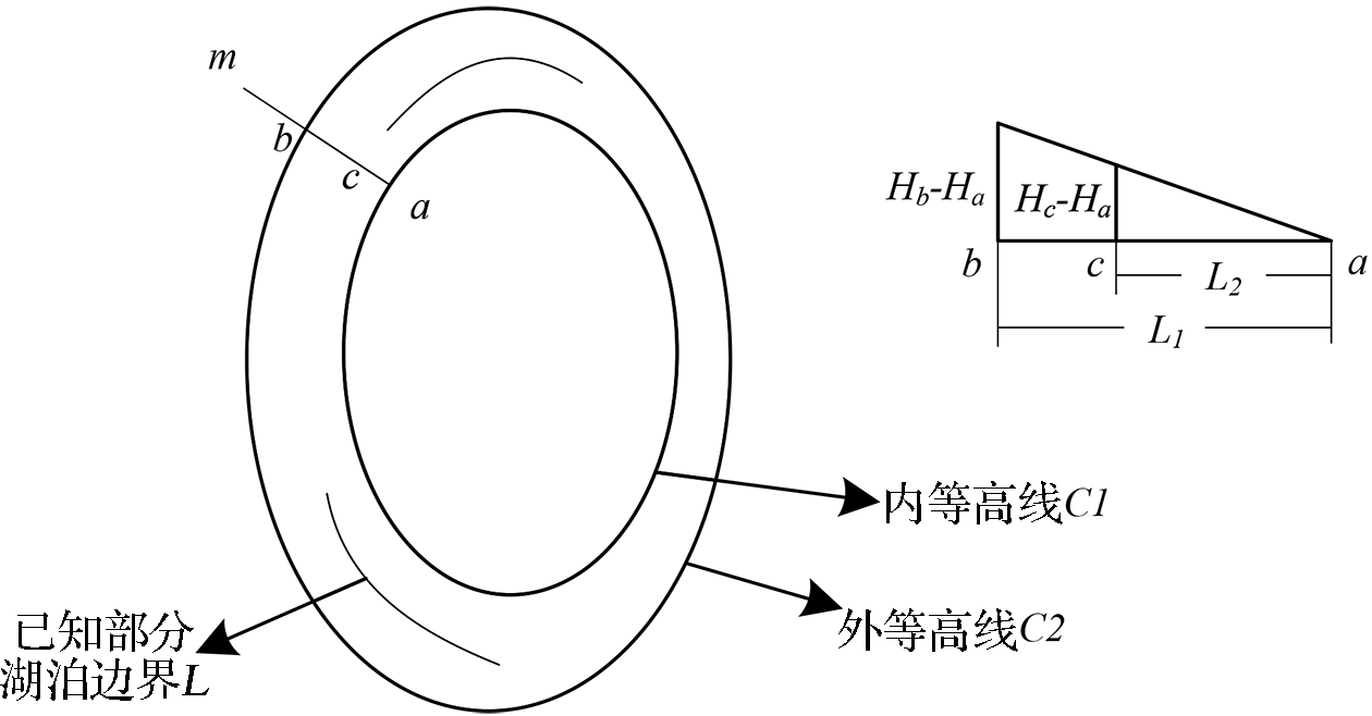
| 图7 湖泊水位相对于内等高线上升时,未知湖泊边界点的插值示意图 |
| Fig.7 Interpolation of the unknown points in the lake boundary in the case of lake level rising relative to the inner contour |
|
|