基于无人机激光雷达的森林冠层高度分析
Analysis of Forest Canopy Height based on UAV LiDAR: A Case Study of Picea crassifolia in the East and Central of the Qilian Mountains
基于无人机激光雷达的森林冠层高度分析 |
| 边瑞,年雁云,勾晓华,贺泽宇,田行宜 |
|
Analysis of Forest Canopy Height based on UAV LiDAR: A Case Study of Picea crassifolia in the East and Central of the Qilian Mountains |
| Rui Bian,Yanyun Nian,Xiaohua Gou,Zeyu He,Xingyi Tian |
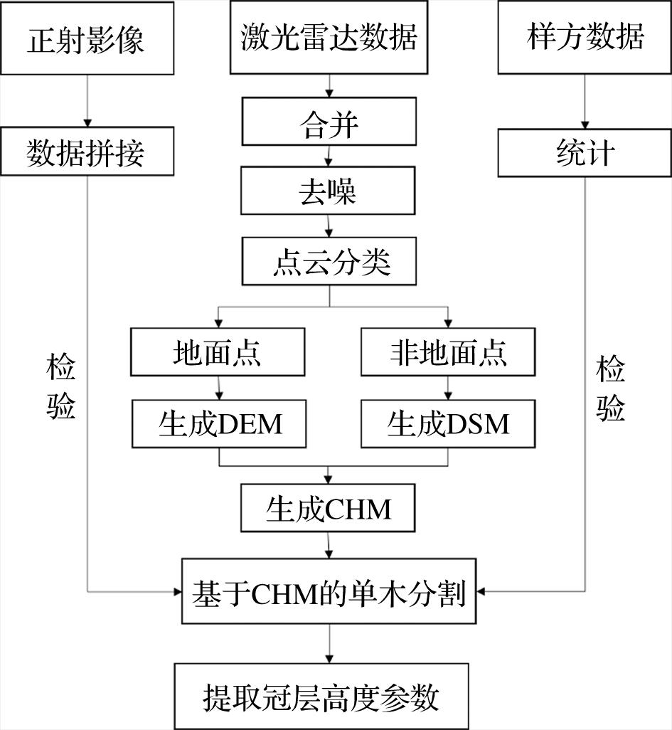
| 图2 激光雷达点云数据树高提取流程 |
| Fig.2 Flowchart of forest height extraction using LiDAR point cloud data |
|
|